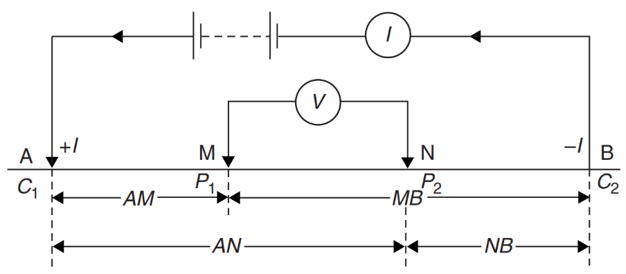
 Geoelectrical measurements are performed using only 4 electrodes
i.e. 2 electrodes are being used to inject direct current (DC) and 2 electrodes are being used for measuring the voltage difference.
Thus, resistivity data was obtained from this mechanism.
The measured potential difference value depends on the rock electrical properties of the medium. Geoelectric is usually
carried out to estimate subsurface geological conditions based on the resistivity distribution of the medium, either
in the lateral or vertical direction.
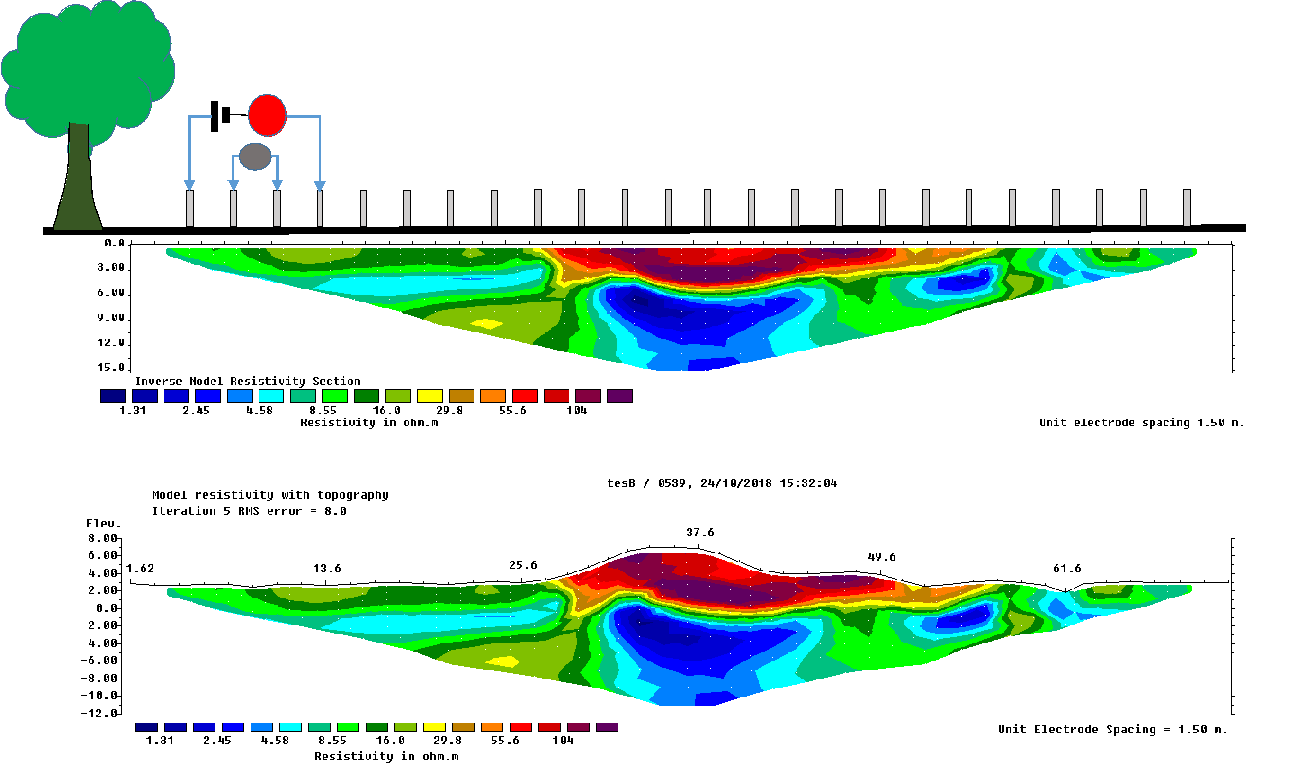
To obtain lateral data distribution, the 4 electrodes are shifted within the same distance configuration.
Meanwhile, to get the vertical distribution (deeper) of data, the distance between the electrodes is enlarged.
The combination of these two techniques will get 2D resistivity data distribution.
 Nowadays, 2D Geoelectrical measurement uses an automatic switching device that functions as a regulator
of displacement of distance configuration and positions 4 electrodes automatically. The device is attached to the
Resistivitymeter that can inject electric current and measure the voltage potential difference.
With this mechanism, the measurement time is shorter than conventional 2D Geoelectrical measurement
but requires more cables, electrodes, and project cost.
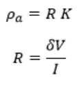
The geometric factor (K) is de?ned by the expression:

Where the ground is not uniform, the resistivity so calculated is called the apparent resistivity (?a):


The main resistivity measurement scheme is a resistivity-meter instrument connected to a DC power source (battery accumulator).
It conducts electricity through electrical conducting wires and then stainless steel electrodes. An electric current is injected
through the electrodes. It flows beneath the earth's surface and generates an electric potential. The potential electric pattern
will be disturbed when contacting a conductive or resistive material. The patterns are measured as voltage potential by the instrument.
The results of geoelectric measurements are a cross-section of a subsurface resistivity value distribution that can describe geological
conditions.
The results of geoelectric measurements are a cross-section of a subsurface resistivity value distribution that
can describe geological conditions.

The main determinants of the resistivity value include and are not limited to the following: Porosity in fractures
or pores, Pore saturation % air or gas, Hydrocarbon fluid content and saturation, Salinity or any Total Dissolved
Solid contents, Clay content, Metallic Sulfide Mineral Content, Fluid temperature, Rock Matrix intrinsic resistivity.
Based on these factors, geoelectric is very capable of determining:
Depth and thickness of aquifers mapping, Aquitards
or Confining layers’ characterization, Structures identification, fractures/faults zone, Mineral and ore exploration,
and some Sensitive issue and Environment problems such as Contamination dissolved chemical, Seawater intrusion, and
soil corrosivity.

